About South Oxfordshire
The district
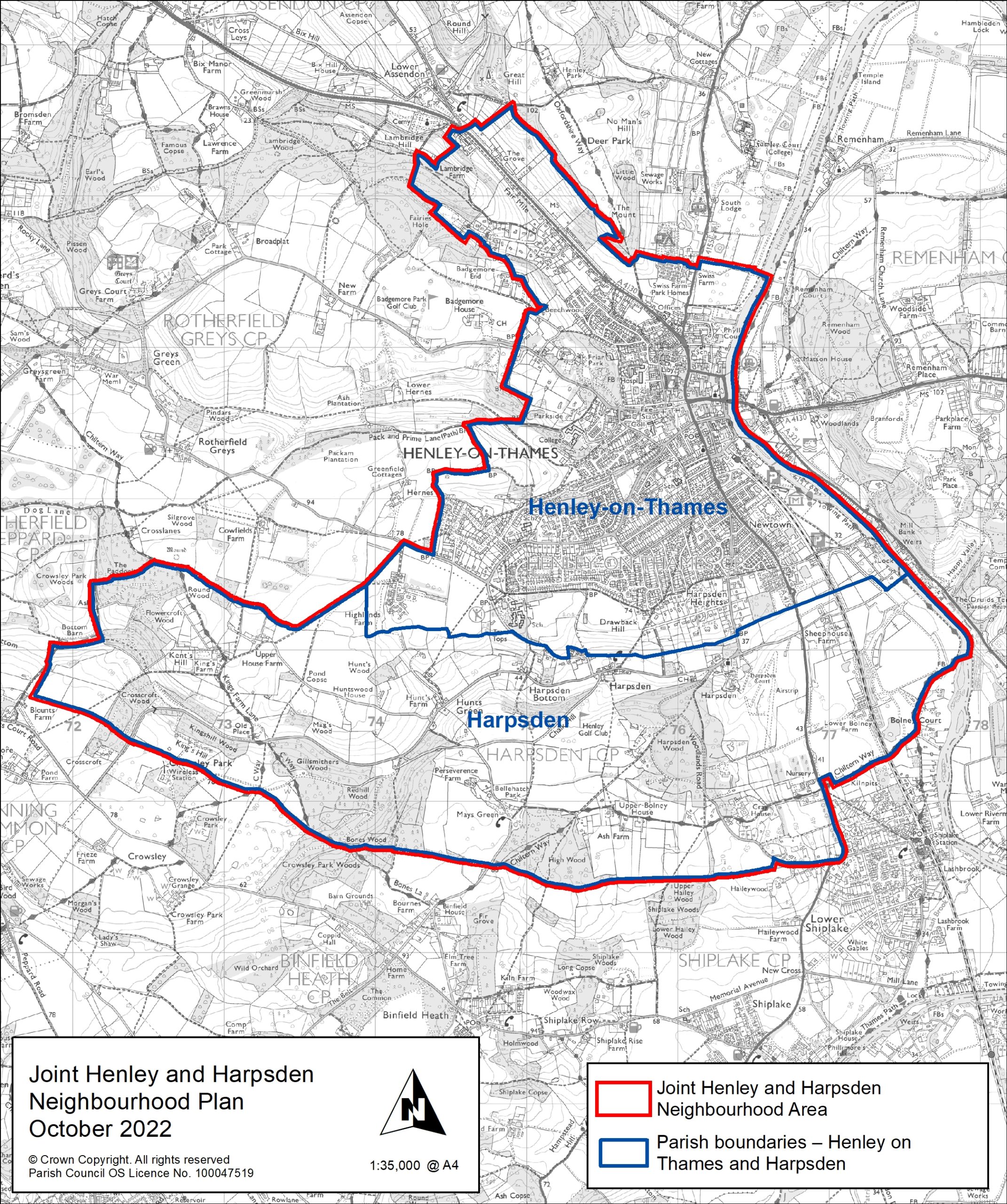
The district of South Oxfordshire covers nearly 260 square miles. Its boundary reaches from the edge of the City of Oxford in the north-west along the borders of Buckinghamshire and Berkshire to the outskirts of Reading in the south. It has four main towns: Didcot, Henley, Thame and Wallingford, with Didcot becoming increasingly dominant as the main urban centre. Within 10 years, some 25 per cent of the district’s population will live in Didcot.
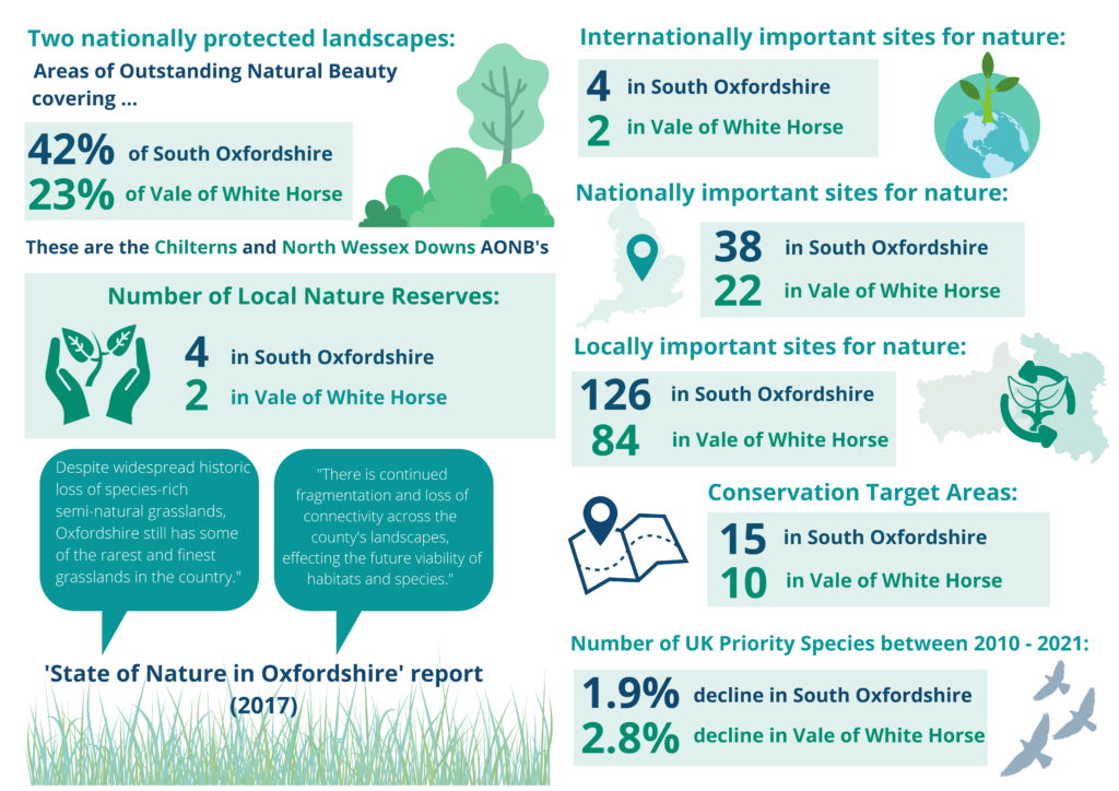
Much of the district is rural in nature, with the land in agricultural use. The main exception to this is the southeast where the wooded Chiltern Hills rise sharply from the Thames Valley. Most of the southern end of the district sits in either the Chilterns or North Wessex Downs Area of Outstanding Natural Beauty (AONB). The northeast of the district forms part of the Oxford Green Belt. In total, around 70 per cent of the district has a green belt or AONB designation. See below a summary of protected landscapes, nature reserves, important sites for nature and conservation target areas for both South Oxfordshire and Vale of the White Horse.
South Oxfordshire is also a popular place to visit, with plenty to see and do. For more information about the many attractions of the district, please see our Visit Southern Oxfordshire website.
Statistics about South Oxfordshire
An estimated 151,820 people live in South Oxfordshire (Office for National Statistics: Mid-Year Population Estimates UK, June 2022).
Oxfordshire Insight and the Joint Strategic Needs Assessment (JSNA)
Oxfordshire Insight is managed by Oxfordshire County Council. It provides access to data on Oxfordshire and its districts, including interactive dashboards and maps.
The Joint Strategic Needs Assessment (JSNA) contains information about the people in Oxfordshire and helps us understand their health and well being needs. The JSNA brings together statistics and data from a number of sources to create a shared evidence base. It is intended to support service planning, decision making and delivery. The executive summary focuses on the headline facts uncovered by the most recent analysis of the data.
The Co-op Community Wellbeing Index
The Community Wellbeing Index was developed by the Co-op to provide insight into the well being of neighbourhoods across the UK. It is designed to help provide users with a snapshot of the strengths of, and challenges facing local communities.
Interactive maps
We have a range of interactive maps and postcode/area searches available on this website to help you find information about South Oxfordshire.
My South Oxfordshire Local Search
Use the South Oxfordshire Local Search to find information about council services in the area, such as rubbish and recycling collection days and council tax rates. You can also find out about local democracy in your area, including who your councillors are and how to contact them. Search by postcode.
Finding local information by map
- Find local amenities map – On this map you can search for car parks, recycling banks, public toilets, and waste recycling sites (rubbish tips).
- Find countryside with public access map – Information on countryside in South Oxfordshire with open access to the public.
Planning maps
- Planning application and decision map – Search for planning applications and decisions by location.
- Planning policies map – will provide details of the relevant planning policies in your area. For example, if the property is in a Conservation Area or an Area of Outstanding Natural Beauty.
- Conservation and listed buildings map – find out if you live in a conservation area or if a property has listed building status.